I.A.CO Ltd
  • Home
  • Profile
    • History
    • Our Team
    • Our Associates
    • Our Clients
    • Equipment – Software
    • Corporate Responsibility
  • Services
    • Environmental Policy
    • Water & Flood Management
    • Waste & Pollution Management
    • Environmental Impact Assessment
    • Renewable Energy
    • Ecology
    • Environmental Information Management
    • Environmental Permitting
    • Research and Development
  • Case Studies
    • Environmental Policy
    • Water & Flood Management
    • Waste & Pollution Management
    • Environmental Impact Assessment
    • Renewable Energy
    • Ecology
    • Environmental Information Management
    • Environmental Permitting
    • Research and Development
  • News
  • Careers
  • Contact
  • Search
  • Menu Menu
Environmental Information Management

CYPRUS SHELF SEABED MAPPING – BYTHOS Project

01/2020/in Environmental Information Management /by netinfo

The main purpose of the BYTHOS Project titled “Cyprus Shelf Seabed Mapping” of the Department of Fisheries and Marine Research (Tender Procedure No. 13/2017) was to conduct a comprehensive Hydrographic Survey in order to improve the knowledge of the seabed topography and the safety of the navigation and the environment.

CLIENT: Department of Fisheries and Marine Research

REGION: Cyprus

TYPE: Environmental Information Management

DURATION: 04/2018 – 04/2019

OTHER PARTNERS: Subcontracted by Lighthouse S.p.A and METRICA S.A.

The aim of the BYTHOS project was to support the ongoing Cypriot national endeavor of improving its seabed topography knowledge, in order to ensure the safety of both navigation activities and the environment. A comprehensive hydrographic survey covering a water depth range starting from the isobath of -50m to approximately -250m with an area of 1.195km2 was the main objective of the Project. Part of the Project – which I.A.CO was awarded – was the implementation of Lights and Buoys survey along the coastline of Cyprus coupled with the provision of support material for nautical publications i.e. photographs shooting of sites such as Fishing Shelters, Ports and Marinas.

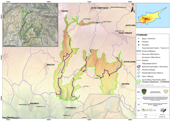
A total number of 51 lights, 76 buoys and 74 sites were provided by the Client, together with the relevant information to be collated and presented in tabular form. All survey items were numbered in a sequential manner based on the list provided by the Client. The coastal area of Cyprus was divided in 9 survey areas: Paralimni, Ayia Napa – Ormideia, Larnaca, Zygi, Limassol, Akrotiri, Paphos, Peyeia, and Akamas – Pyrgos. The offshore activities, with a total duration of 11 days, were executed by a boat, while one day of onshore surveying activities was required for surveying the listed items. A GNSS (Global Navigaiton Satellite System) GPS system was used for the offshore and onshore survey.

The tasks that were successfully completed and the services that were provided are the following:

  • Survey of the listed lights provided by the Client. For each light, a table containing information such as location, structure description and height, was filled.
  • Survey of the listed buoys provided by the Client. For each buoy a table with information such as the type and name of mark, the shape and the color of the buoy, the color and the rhythm of the buoy’s light, was filled.
  • Identification and survey of new lights and buoys.
  • Photographs shooting of 74 sites that were provided by the Client including Ports, Marinas, Fishing Shelters, private installations, major industrial and urban areas, marine protected areas, etc.
  • Additional photographs shooting of other new sites, which were considered “points of interest” within the scope of the Project.
  • Production of Maps for each survey area showing the findings of the survey.
  • Submission of a “Lights, Buoys and Sites Survey” Report to the Client.

Share this entry
  • Share on Facebook
  • Share on Twitter
  • Share on WhatsApp
  • Share on Pinterest
  • Share on LinkedIn
  • Share on Tumblr
  • Share on Vk
  • Share on Reddit
  • Share by Mail
http://www.iaco.com.cy/wp-content/uploads/logo_white.png 0 0 netinfo http://www.iaco.com.cy/wp-content/uploads/logo_white.png netinfo2020-01-15 12:03:472020-01-24 14:52:29CYPRUS SHELF SEABED MAPPING – BYTHOS Project

Case Studies

  • Environmental Policy
  • Water & Flood Management
  • Waste & Pollution Management
  • Environmental Impact Assessment
  • Renewable Energy
  • Ecology
  • Environmental Information Management
  • Environmental Permitting
  • Research and Development

“Addressing needs in an engineering sound and environmentally sustainable manner.”

Links

Home | Profile | Services |
Case Studies | News | Careers | Contact

Contact Us

  • Address: 3 Stavrou Ave. Office 202, Strovolos 2035,
    P.O.Box 28401, Nicosia 2094, Cyprus

  • Telephone: +357 22429444
    Fax:
    +357 22519904

  • Email: [email protected]

  • Website: www.iaco.com.cy

Follow

Share

News

  • IACO was at the European Researchers’ Night11/2020 - 12:35
  • I.A.CO has signed a Contract with the Presidency for the elaboration of a Strategic Environmental Impact Assessment Study for the National Development Strategy of the Mountainous Communities of Troodos10/2020 - 09:45
  • I.A.CO along with its associates were assigned by Water Development Department to perform a Master Plan for the use of the Tertiary Treated Water of the wider area of Limassol09/2020 - 15:52
Copyright 2016 © IACO, All Rights Reserved. / Powered by NETinfo Plc
  • Sitemap
  • Conditions of Use
Environmental Impact Assessment of four Clay Material Borrow Sites to be used... ΤΗΕ CREATION OF A DISPERSION MODEL OF GASEOUS POLLUTANTS IN THE ATMOSPHERE...
Scroll to top